The Higanesan & Jukkoku-toge Hiking Course
This is a “hiking course guided by Buddha,” in which Buddhist images at important points along the route act as a guide of sorts.
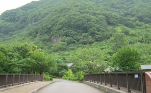
To get started, take a bus for Oku-Yugawara/Fudodaki from Yugawara Station, and after about 10 minutes get off at Ochiai-Bashi Bus Stop. At the far end of the bridge stands a stone Buddhist image, and a pagoda that reads “The starting point of Higanesan Road.” You can find the guide map for the Higanesan & Jukkoku-toge Hiking Course just ahead.
Found along the route, Higanesan Tokoji Temple is an old temple of the Shingon sect, said to have been founded by Matsuba Sennin as a place for ascetic mountain worship. At the back of the temple are the hokyoin-to (stone pagodas) belonging to the graves of Matsuba Sennin, Mokusho Sennin and Konji Sennin, which are called “Higane no Sansenninzuka” (“three burial mounds”).
The principal image of Tokoji is the brass statue of the guardian deity of children, as well as many other stone Buddhist statues, a five-ring tower, and a three-storied stone pagoda within the precincts of the temple. Some of the most eye-catching are the statues of the Great King of Hell, Enma, and the pitiless hag, Datsue-ba, which are placed on both sides of the entrance. When the dead are on their way to the other world, Datsue-ba strips them of their clothes by the side of the Sanzu River in the Buddhist underworld, which is analogous to the River Styx in Greek mythology. She is also called “Sozuka no Uba.”
Tokoji Temple is crowded with visitors during the equinoctial weeks of spring and autumn. There are several pilgrimage roads for accommodating these visitors, which originate in various parts of the country. Of particular interest is the road leading to the temple from Atami City, near the border with Kanagawa Prefecture, which has been revamped as “the hiking course with stone Buddhist images.”
This course was built by widening and improving a narrow path which had fallen into disuse. Images called “chobutsu,” which served as guideposts, were inspected and new ones were installed if necessary. Chobutsu are located at every other cho (109 meters) all the way to Higanesan Tokoji Temple, and new ones were also installed at every half-cho. Their appearances can vary, such as older ones covered with moss, which is especially apparent when new and old ones are together. They can be found on both sides of the road, and if you don’t pay close attention, you are likely to overlook some of them. However, since there are also traditional guideposts for the hiking course, you needn’t worry about losing your way.
A little higher up after 19-chome is the water tank of the Izumi reservoir, which is the trailhead of the Higanesan Hiking Course.
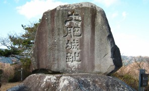
Beyond 21-chome you’ll see a big stone Buddhist image, with a stone monument beside it inscribed with “Halfway up Higanesan.” This is accurate given that it is 42 cho to the top.
Go up along the broad road from the left of Tokoji Temple, and you’ll find a monument inscribed with a tanka poem by Sanetomo Minamoto, the third shogun of the Kamakura era, in the middle of the road.
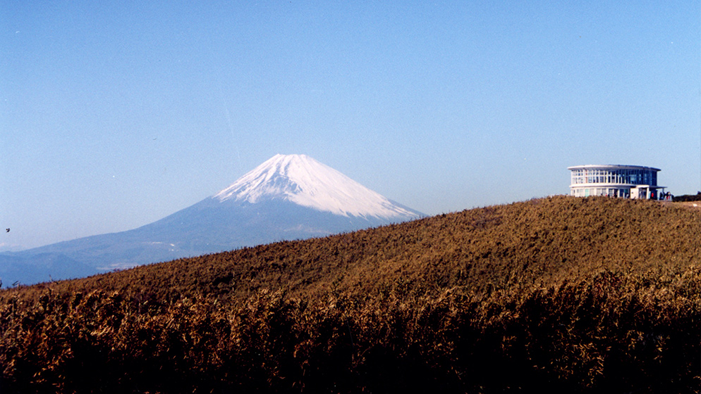
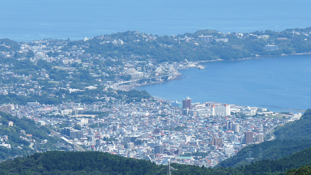
True to the “ten countries/provinces” meaning of “Jukkoku,” Jukkoku-toge Sancho Station on Higanesan overlooks ten provinces: Izu, Suruga, Totoumi, Kai, Shinano, Musashi, Sagami, Awa, Kazusa and Shimousa. The view of Mt. Fuji from there is beautiful as well.
It is 5.3 kilometers from Ochiai Bridge to this spot, and the course takes about 2 hours and 30 minutes. If your legs are still strong enough, you can challenge Himenosawa Park’s athletic hiking course, or visit Izusan Shrine.